Geology
Always evolving with water, rock, and time, Zion National Park is still a work in progress.
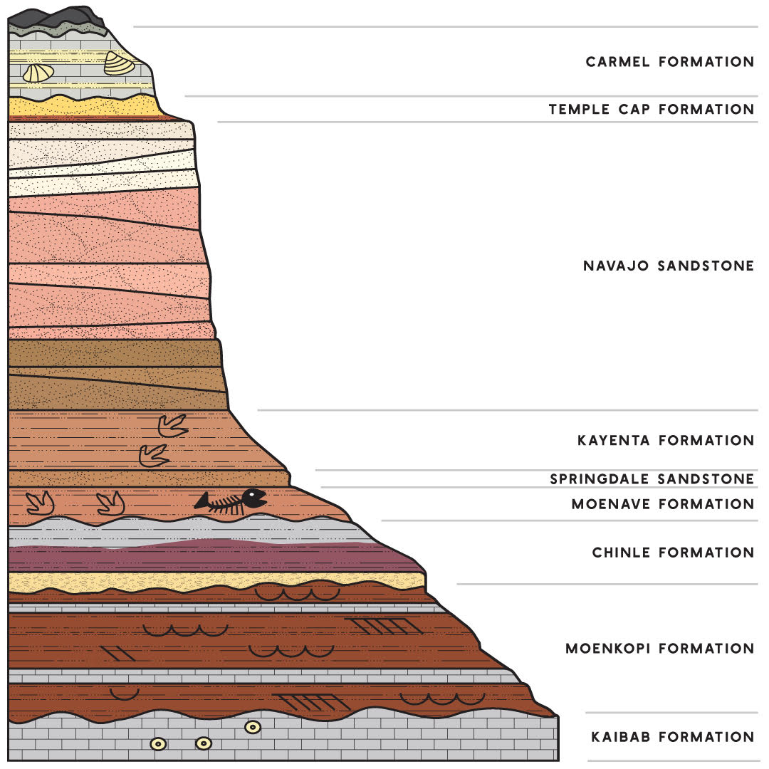
The iconic rock structures that form Zion National Park are made of layers of sedimentary rock. Dating back millions of years, each layer tells a different story about the land’s steady journey from a flat, sea-level basin to the towering canyon walls and cliff faces we observe today.
Zion’s rock layers, from youngest to oldest:
Cedar Mountain Formation
- Formed ~120 million years ago.
- Composed of conglomerate and sandstone.
- Deposited by inland-flowing rivers.
Carmel Formation
- Formed ~170-165 million years ago.
- Composed of limestone containing marine fossils, mudstone, sandstone, and gypsum.
- Deposited in a shallow interior seaway.
Temple Cap Formation
- Formed ~175-170 million years ago.
- Composed of sandstone and mudstone.
- Formed by coastal sand dunes and tidal flats.
Navajo Sandstone
- Formed ~185-180 million years ago.
- Composed of cross-bedded sandstone.
- Formed by wind erosion in a sandy desert environment.
Kayenta Formation
- Formed ~195-185 million years ago.
- Composed of reddish-brown sandstone, pink sandstone, varicolored mudstone, and siltstone.
- Deposited in streams and rivers within an arid environment.
Moenave Formation
- Formed ~210-195 million years ago.
- Composed of reddish-brown sandstone, siltstone, and varicolored mudstone.
- Deposited in streams, floodplains, and lakes.
Chinle Formation
- Formed ~210-225 million years ago.
- Composed of mudstone, siltstone, sandstone, and conglomerate.
- Deposited in channels and floodplains of a large river system.
Moenkopi Formation
- Formed ~240-250 million years ago.
- Composed of reddish-brown mudstone, sandstone, and siltstone.
- Deposited on broad tidal flats, slow-moving rivers, and floodplains of a broad coastal plain.
Kaibab Formation
- Formed ~270 million years ago.
- Composed of marine limestone and siltstone.
- Deposited in a shallow tropical sea and coastal flats.
Learn and see much more about these layers when you visit Zion National Park or the Greater Zion Visitor Center. All of these options contain detailed information and further resources for delving into the park’s geological makeup.